Chart Data Options for SonaSoft
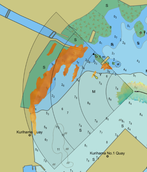
The practice of using chart overlay greatly improves end user’s experiences. Chart overlay enables users to easily correlate in-water targets on the sonar's display to the locations of potential navigation obstacles. It also allows users the ability to have high confidence in their charts by confirming that bathymetric features line up with the sonar. That is why FarSounder’s team works hard to make it easy for end users to add charts to the FarSounder systems. One way to encourage chart use is to make sure FarSounder software supports importing S-57 and S-63 charts in SonaSoft as part of the base software.
S-57/S-63 Chart Engine Benefits
The visualization offered when using chart overlay is very helpful for end users. The S-57/S-63 chart support has been added to give vessels a more cost effective solution for including chart overlay to the Argos systems. Furthermore, this supported chart engine is compatible with all update features from version 3.15 and on. This compatibility offers improved situational awareness through AIS/ARPA overlays (example video). These overlays are extremely useful for well traveled areas, allowing users to identify unexpected in-water targets like vessel wakes. It also allows for update features like extended Local History Mapping (example video).
Common Chart Sources for ECDIS Users
Often for ECDIS users, S-63 data is already being used inside other bridge systems on the vessel, and in many cases the existing chart subscriptions can be applied to the FarSounder bridge station with little or no additional costs for chart data license. In order to add charts to the FarSounder the User Permit Number (UPN) of the FarSounder computer needs to be given to the chart provider so that permits can be generated for the ENC cells that have been licensed. Some common chart sources are:
Admiralty (AVCS): SOLAS compliant S-63 chart supplier
Primar: SOLAS compliant S-63 chart supplier
Navtor: SOLAS compliant S-63 chart supplier
7Cs: SOLAS compliant S-63 chart supplier
Common Chart Sources for non-ECDIS Users
If S-57/S-63 chart formats are being used inside other bridge systems on the vessel these charts can likely be added to the FarSounder system with little to no additional cost. Please note, if the vessel is using S-63 charts the User Permit Number (UPN) of the FarSounder computer needs to be given to the chart provider so that permits can be generated for the ENC cells that have been licensed.
If the vessel is using a proprietary chart format it will not be compatible with FarSounder’s chart engine. However, there are a variety of other chart sources available for the FarSounder. One option for vessels navigating in US waters is NOAA S-57 charts, which are free to the public.
Here are a few chart sources:
NOAA: Offers free S-57 charts of all US waters
Chart World: SOLAS compliant and recreational chart supplier in various formats from various providers
Activating Tide Height Predictions
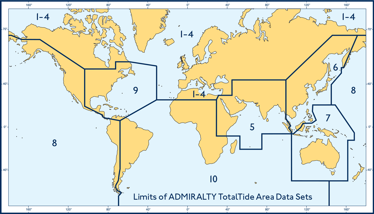
In order to enable the extended LHM capabilities in the Chart Viewer and in the 3D Omni Viewer, the depths recorded must be corrected to a common reference point. FarSounder does that using tide height predictions for the vessel’s location from Admiralty TotalTide. More on this is described here, in summary activating tide height predictions allows the data to be stored with a consistent vertical reference and stored indefinitely. The costs associated with activating Admiralty TotalTide is ~$108/year for each are required (the world is divided into 9 zones, see the Figure below).
Admirality TotalTide area map.
Legacy Chart Users(Professional+)
I4 Insight’s Professional+ charts are also supported in a legacy mode, but are not recommended. The Professional+ chart engine does not include AIS/ARPA overlays and extended LHM capabilities. FarSounder previously used the Professional+ chart engine which only supported Professional+ charts (formerly from CMap, now sold by i4 Insight) in the base package. If there is interest in using the i4 Insight charts, the Professional+ chart data in S-57/S-63 format is available through various sources including Chartworld. Obtaining the data in the S-57/S-63 format is the recommended procedure for customers interested in using Professional+ data as it will allow access to all of the latest software features.
Chart Data Installation Steps
For S-63 format, the User Permit Number (UPN) of the FarSounder computer needs to be given to the chart provider.
If importing S-57 format ENCs, the UPN and permit files are not required (skip this step).
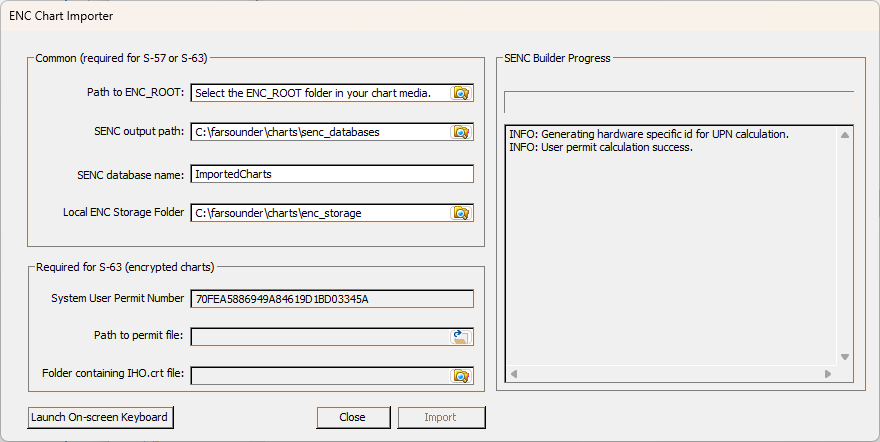
Run the ENC Importer (a shortcut is made on the desktop during installation).
Specify the location of the charts by selecting the location of the ENC_ROOT folder. This will be the folder which has all of the charts.
Choose a destination folder for the converted charts to be stored by default this will be "C:\farsounder\charts\senc_databases"
Specify a name to use for the database, by default this is "ImportedCharts".
Next, add the path to the permits file and the IHO.crt file in the respective input fields. (Skip step 6 for S-57 format charts)
Lastly, click the "Import" button to import the charts. This can take a while. Once finished, the new SENC will be automatically registered and will display the next time SonaSoft™ is opened.
Figure: ENC Importer
Note: The hardware specific User Permit Number for a given FarSounder computer is displayed in the lower left of the dialog. If S-63 format ENCs are chosen, this number should be given to the chart data provider so that appropriate permits can be generated for the licensed ENC cells.
FarSounder’s team feels that chart overlay has a positive impact on the end user’s experience, so the S-57/S-63 chart support has been added to give vessels a simple and affordable chart solution. There are various chart sources for ECDIS and ECS users, and FarSounder’s team highly recommends taking advantage of chart overlay. In order to stay up to date with new features you can sign up for FarSounder’s Newsletter to get all the details on Software Updates, hardware updates, and FarSounder events!


